Category Archives: Uncategorized

Family friendly mountain biking in Morzine

The Portes du Soleil is one of the best places to go mountain biking in the world. I’ve biked in a few of the other best places and they are all great. I ran an MTB company from Morzine for 10 years (Endlessride – it is no longer!) and between them our guests and our guides have been to ALL the great places on their bikes. We never could decide where the best place to go was. Morzine was on the list though.
But is it a suitable places to go if you are a beginner? Or have a young family? Is there any family friendly biking in Morzine? We would usually guide families and beginners full time. We could keep them safe but we knew that without local knowledge a beginner could find themselves out of their depth in moments. We saw it every day. Since we started our in the year 2000 the situation has improved bit by bit every year. 16 years on the Portes du Soleil is a very different place. There is no escaping the fact it is orientated towards the downhill rider, despite this the various tourist authorities have tried to soften things a bit to appeal to their preferred customer, the active family. The best evidence of this is the Multi Pass. 2€ a day to swim, skate, play tennis and use the lifts (to go walking, not biking!!)

ecureuils

Les Ecureuils, start here, if this is too much go back to the Dereche


Morzine itself doesn’t have the best family friendly trails. Chatel and Les Gets do. It does site in between these two towns though, so for the most variety it may well be the best base. If you are not sure, and this can often seem a bit overwhelming, then hire a qualified MTB guide. At least to start. I can recommend some. Just ask! Otherwise read on…

Morzine/Les Gets

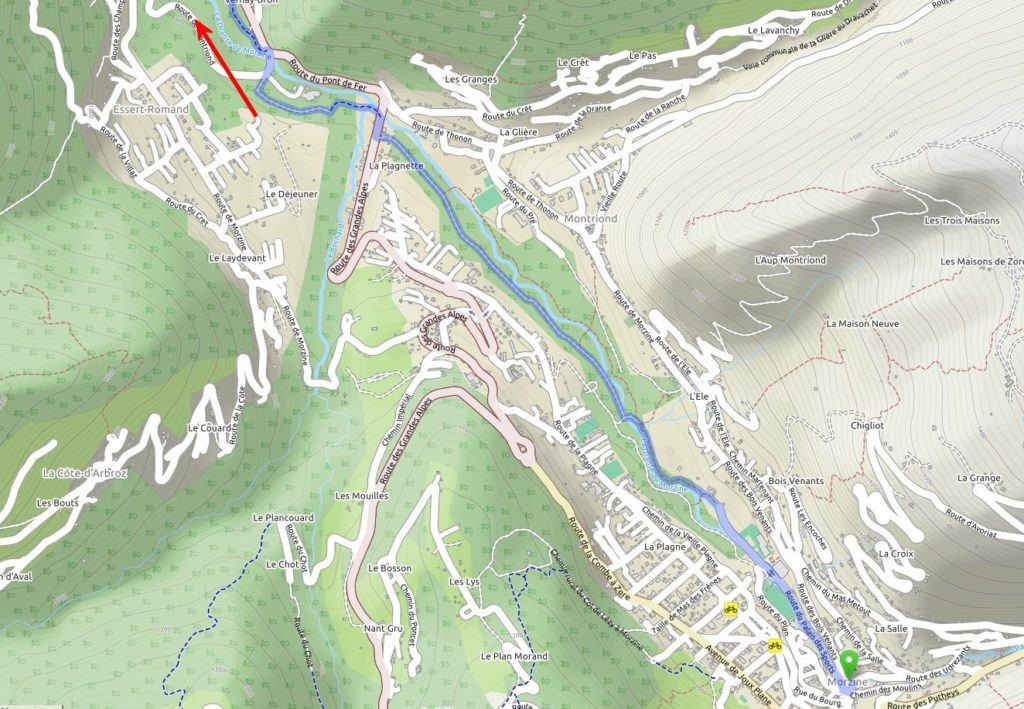
The most family friendly MTB trail is the footpath that runs up and down the river. No ski lifts required! It starts by the outdoor swimming pool (and new skate park) and runs on both sides of the river. Called the Parc des Dérêches it is suitable for all ages and almost flat. The easiest longest circuit in the park itself is 10km, it’s easy to extend beyond this on the well sign posted path towards St Jean d’Aulps and even then (take a map for this bit) on to Le Biot, 95% off-road and suitable for everyone. From Morzine to Le Biot and back is 28km, it is a “there and back” ride unless you are happy riding on the road. And for most families I would recommend against this. It is too busy. It’s also a great wet weather alternative to using ski lifts for more experienced riders. Just watch the wooden bridges when it’s wet! The picture below is the start of the route. The full route is available on openstreetmap. Or the paper map Morzine IGN Top25.  You can even get the IGN map online now too.
dereche

The Morzine section of the best family bike ride in Morzine, the Dereche, the red arrow points towards St Jean d’Aulps

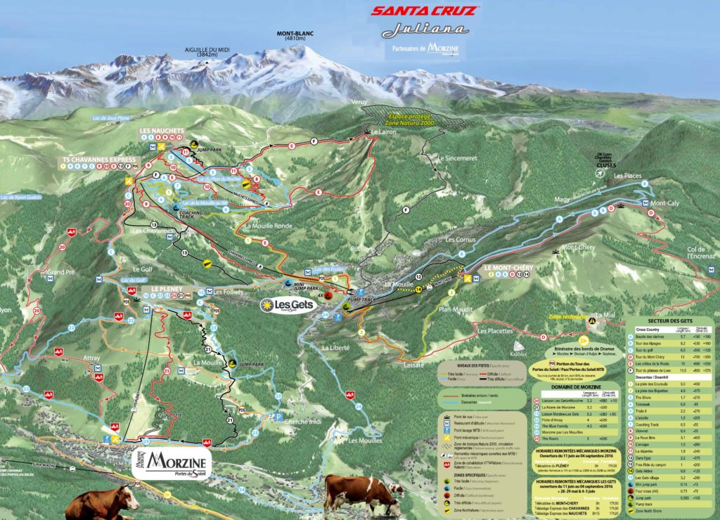
The Morzine and Les Gets MTB maps are available for download here. A high res image is below.

morzine

Some more ideas for the family on a bike. The following are “itinéraire”, so not marked and patrolled routes. Starting in Les Gets.

Route A “Boucle des clarines“, 6km on Mont Chéry in Les Gets. Very easy, wide open track, great views on Mt Blanc. I have never made a specific trip just to do this. It’s there anyway, the Route B that seems to follow on from this is a road. A quiet one. So for a really basic family trip, take the Mont Chery lift, ride route A and then descent back to Les Gets on the road via Mt Caly.

Route D “Tour de Mont Chery” is more like XC mountain biking. 13km and highly recommended. Family friendly, like a blue route at a UK trail centre, as long as the family doesn’t mind heights! Marked as a “Zone technique” on the map. We used to refer to this trail as “the dangerous trail”, thanks to the warning signals.  The tricky section does often close due to landslips.

Route F “Tour du plateaux de Loex“, a black route! Probably because of the distance (14km) and the fact you will need to be more self sufficient and may end up consulting your map. If Route D went well, then technically this will be fine too. Be careful, a wrong turn down to the Samoens valley will end the day in tears. The easiest way back to Les Gets will be in a taxi!

As far as the actual MTB “pistes” go, start with #1 “La piste des Ecureuils” – “the squirrel piste”, AKA “The Family DH“. It’s a beauty and is a perfect introduction to the type of MTB piste the area has to offer. If you struggle on here then don’t move on from the green’s. It’s so good the full on DH brigade love it too, which is fine if they give the families a wide berth (they often don’t), so beware when stopping to admire the view and get off the piste and out of their way!

#20, the return from Les Gets to Morzine should be OK. It’s marked as a red. Probably because of the steep section after the Atray restaurant (stop there for a drink!) though you can always walk this section. The best easy route home from Les Gets to Morzine is probably #24  “Morzine par Les Mouilles“.

#22 or #23 are your best options from the top of Pleney, both blue runs, these both have berms and steeper sections though. My preferred choice is #22. I think #23 is slightly harder and often a bit wetter. The best of it is over by the time you get to the Cherche Midi car park, from here you can keep going until you get to Morzine or turn left and head back to Les Gets via the road of the “Morzine par Les Mouilles” in reverse.

The liaison with Les Gets is a strange one. It’s marked as a red and justifiably so. If this is going to be too much then (and you’ll need a map) start down it but nip on to the road at Nabor and roll down to Les Gets from there. You can carry along it, the route is straightforward but it’s hard not to get sucked into the main Les Gets downhill, somewhere you don’t want to be with a family!

Avoriaz/Chatel

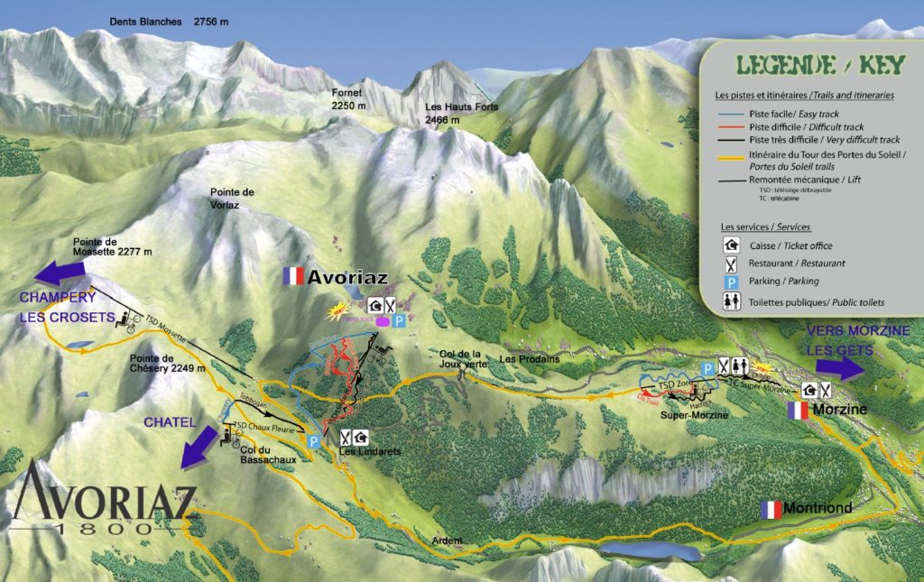
From Morzine this is a day out. It can be shortened by taking a car around to Linderets. I’ve described it from Morzine itself. Head up the Super Morzine telecabine and then the Zore chairlift. At the top there is a wide, smooth and sandy track that leads towards Avoriaz. After a few km you’ll arrive at the Col de la Joux Verte. From here the MTB route is well signed posted but probably too hard for most children. The safest thing to do would be to descent the road to Linderets. From here the Chaux Fleurie chair leads to the Chatel bike park.
Avoriaz

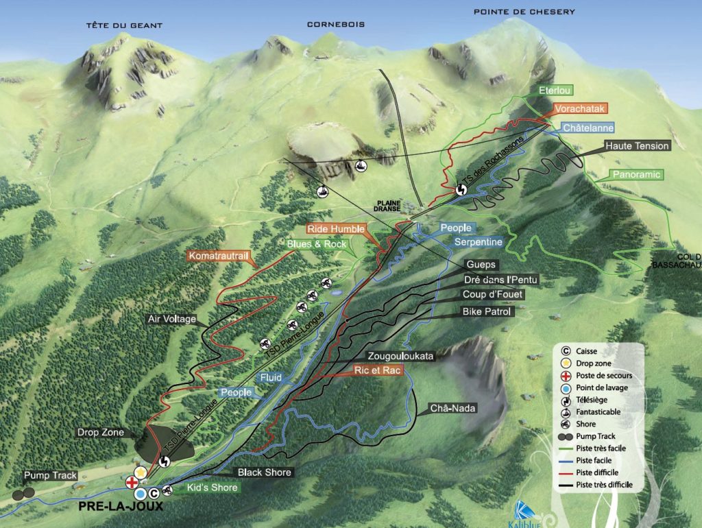
Chatel MTB piste maps are available for download here. Start off on the green run, Panoramic, one of the classics of the area. Not to be missed. For most this is enough. For some this is already too much. If Panoramic is your limit when you arrive at Plaine Dranse head back up the lift! If you think you can take a little more then head down the blue run, Serpentine. I’ve just spotted Eterlou on this years map (2016), it’s marked green, either it is new for this year or I’ve missed it. Either way I can’t offer advice yet. I’ll check it out when the area is open at the end of June.

chatel

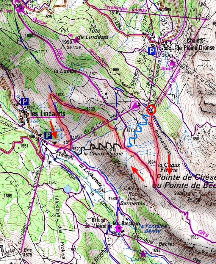
Getting home from Chatel is another of those little issues that a family MTB team can face. Especially if green runs are the limit. The easiest option when stood at the top of the Rochassons chair is to hike up a few metres to the Fantasticable (marked as a red circle on the map below) and then take the path signposted towards the Mossettes. This will take a big dog leg back on itself, signposted for Linderets. Then stick to the path marked GR5 back down to the valley. This is a winter ski piste lower down, fairly steep and gravelly, not ideal but it is the easiest way.  I’ve highlighted the path to take in red. I’ve also marked an obvious blue run called Chesery with a tricky steep start and then a black run, Toboggan which is aptly named. These are the “official” ways down.

Avoriaz return


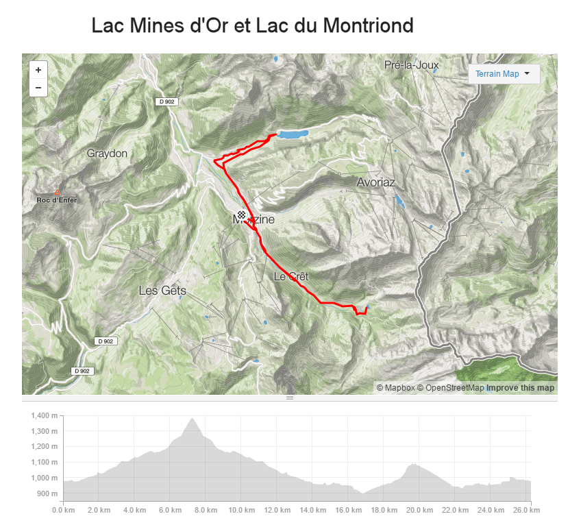
Remember walking with your bike is better than falling off your bike! From Linderets the best route back to Morzine is to ride down the road, yes the road (at certain times of day it can be a bit crowded) descend from Linderets to Ardent and follow the signposted bike route around the Lac Montriond back to Morzine.

So that’s enough to keep you going for 3 or 4 days. One last tip, you’ll notice most people are wearing protection, knees and elbows and full face helmets. For the riding I have described you’ll need a helmet, full finger gloves and I recommend some knee pads too. They will mean that if you do fall off you will probably be able to ride the next day. Without them you’ll loose so much skin that cycling will seem far less appealing!


Col de Joux Plane Open or Closed?

Is the Col de Joux plan open or closed? The answer is further down. First I will set the scene.

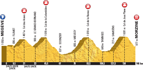
The Tour de France is coming to the Haute Savoie in 2016. The Queen Stage is Stage 20, the penultimate stage but final day of racing. It’s from Megeve to Morzine  and scheduled for Saturday July 23rd . 146km long with about 3,500m of ascent. To add to the hype this stage has also been chosen as the Etape de Tour 2016 , this will be held on July 10th. 15,000 riders are signed up, it’s so popular the entries closed back in 2015! There are all sorts of previews of the route available on the web, this is one of the best.

The climbs are iconic, the Col des Aravis, Col de la Colombiere, Col de la Ramaz and Col de Joux Plane, because of this many cyclists are trying to ride the route prior to the event. The issue is that they have been covered in snow all winter and 3 important sections have major road works on them!

PROFILE for Megeve to Morzine

Stage 20 profile


So are they open or closed? I’ll write this from my own knowledge, updated on May 19th/2016 ,I’ll add some pictures and other resources that might help at the end.

In order that they’ll be ridden.

Col des Aravis, no issues here. This stays open all year

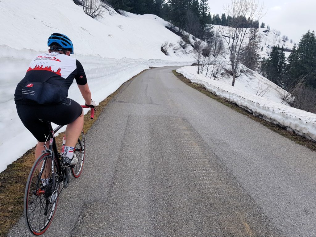
Col de la Colombiere, closed to traffic but being ridden by many. No major issues.

Col de la Ramaz, officially closed but the summit is passable over about 300m of gravel. It needs tarmacking. This won’t put most cyclists off. Passable by car too. Though officially closed.

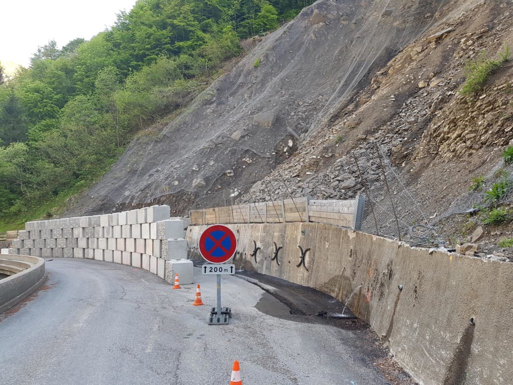
Descent from Praz de Lys to Taninges. Just before the Pont des Gets at 1100m altitude the road is closed to traffic thanks to a long term issue with a landslide. There is an official diversion via the Col de l’Encrenaz which works well for cyclists based in Morzine or Les Gets but it is a big detour for someone trying to ride the official route. UPDATE MAY 21st … In fact the issue (pictured below) is the fear of a spontaneous release on the landslip. There is a wall protecting the road and it is easy to pass. When this section is open the council erect traffic lights and place two full time “spotters” to keep an eye on things. Maintaining this presence out of season obviously costs too much – hence it is closed.

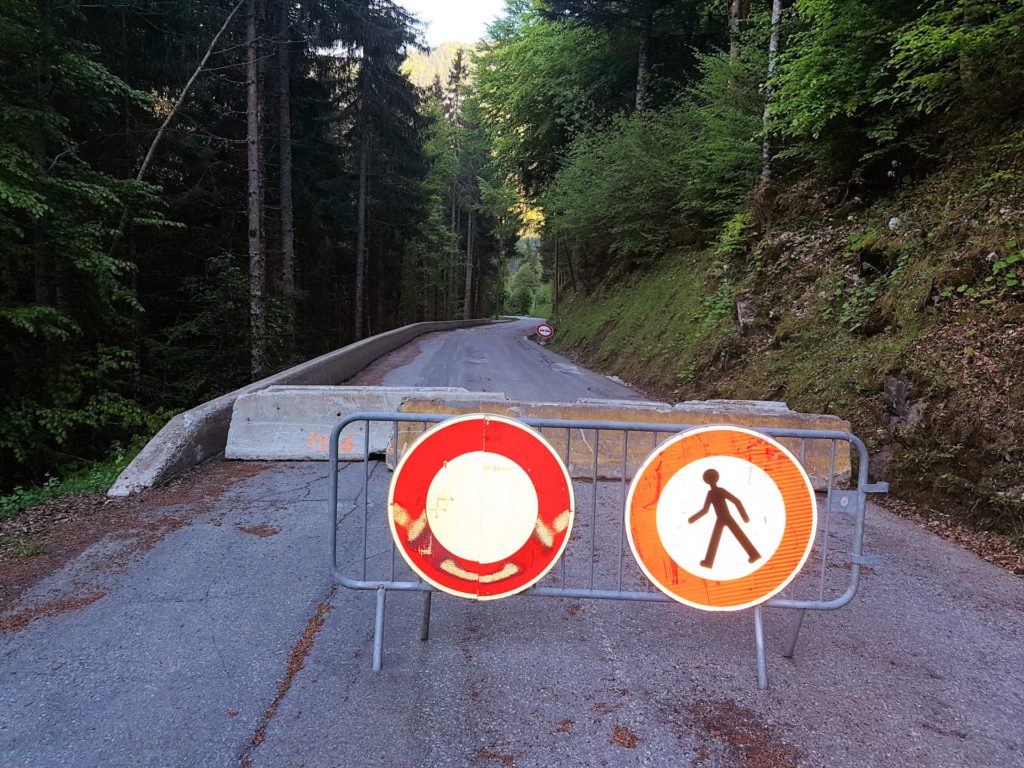
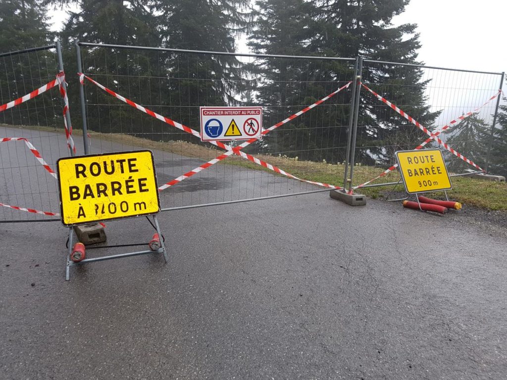
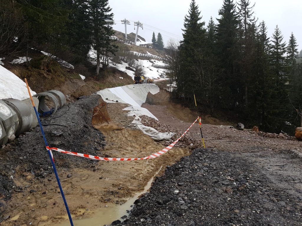
Col de Joux Plane, closed to traffic thanks to ongoing repairs to a landslip at 1640m altitude, just down from the Col du Ranfolly on the Morzine side. It is passable on the weekend by a bike but not recommended, crossing the hole with the bike on your shoulder is slippery and muddy too. I suspect a cyclist will be turned away when the building site is operational.

Col de la Ramaz

Col de la Ramaz , 300m of gravel, May 2016


The closed part of the road before the landslip on the way to Praz de Lys (Ramaz descent)

The closed part of the road before the landslip on the way to Praz de Lys (Ramaz descent)


The retaining wall by the landslip, no ongoing work and easy to pass.

The retaining wall by the landslip, no ongoing work and easy to pass.


Col de Joux Plane closed

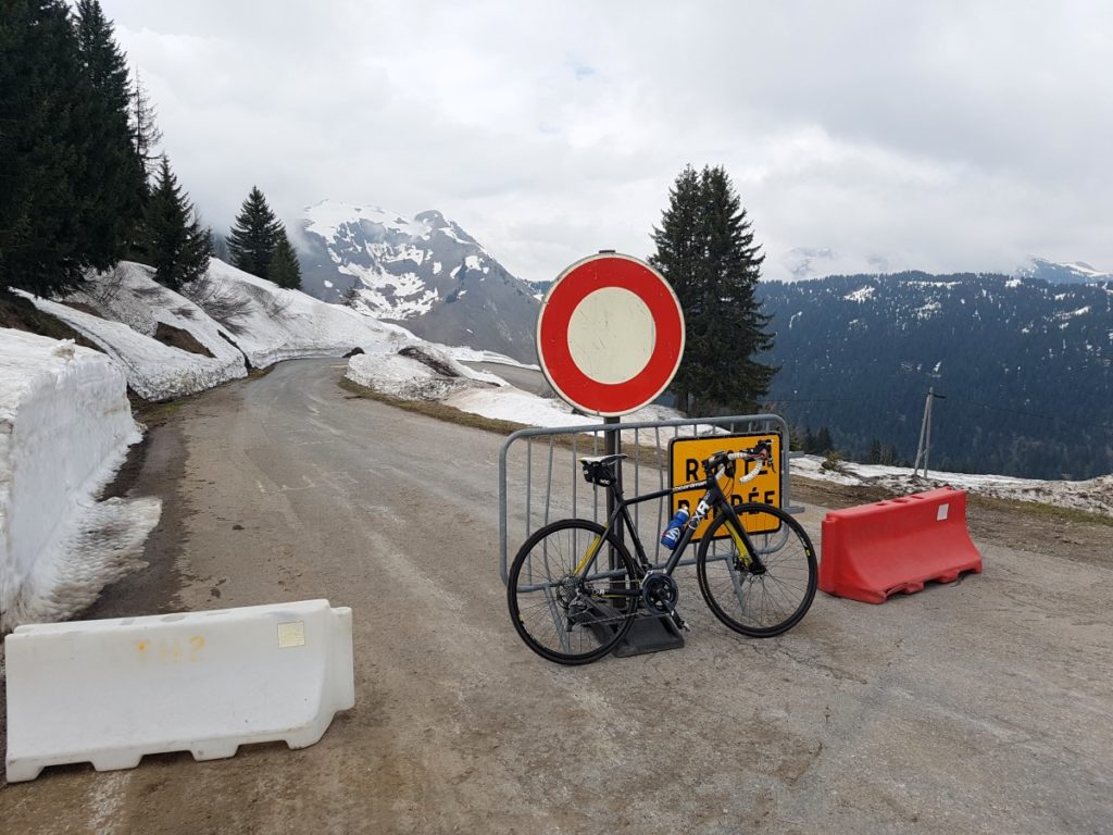
Col de Joux Plane, closed! No doubt left by these signs.


hole in the Col de Joux Plane

The hole in the Joux Plane road.

UPDATE 06/07/2016

The hole on the Joux Plane has been repaired!

jp with tarmac

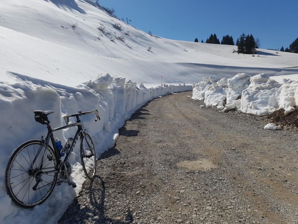
Out of interest, the Joux Verte road from Linderets to Avoriaz is closed to traffic but passable by bike.

road closed

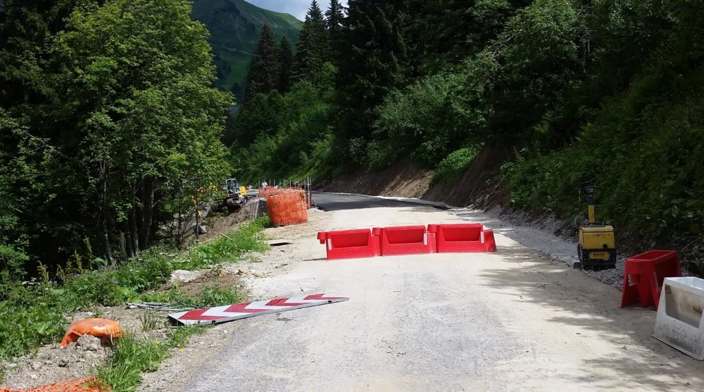
Col de la Joux Verte, closed to traffic but passable by bike


Joux Verte

Lower down the Joux Verte road towards Linderets.


Further resources are available on these links.

These are probably the best, though currently they differ from my first hand knowledge.

http://www.cols-cyclisme.com/ouverture-cols.htm

http://www.sport-passion.fr/parcours/etat-cols.php

This is the official one.

http://www.inforoute74.fr/

and for the Haute Alpes

https://www.inforoute05.fr/wir3/cols.html


The Rhone Cycle path, Swiss section

Rhone Route by bike (Swiss bike routes, Route 1)

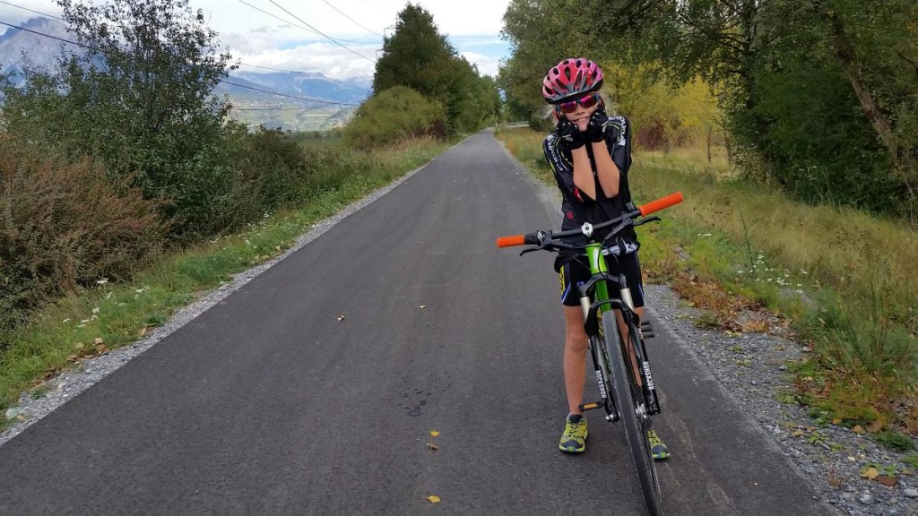
This is part of my long series of “things to do in the mountains that don’t necessarily involve mountains”. Sometimes the kids don’t react well to my “lets go for a walk up a mountain” routine on the weekends and I’m left wondering what else to challenge them with. My youngest is almost 10 and she is very keen on her bike. It can be a hard to find different routes to try out of season from our base in the Portes du Soleil. Her previous distance record was 40km around lake Annecy, when I suggested we try and beat that she was keen.

rhone_cycle_route_1

I had in mind that the Rhone valley (the Swiss bit) might provide an almost flat route that would suit the challenge. I’d also like to stay on cycle tracks. It helps us both stay sane. Whatever anyone says about how safe cycling is, mixing 9 year old’s and busy roads is not recommended.

I’m going to stop emphasising that we did this in Switzerland now. Just to say, that one day this cycle path will extend through France to the Mediterranean coast. At the moment it is not finished. More information on the French route is available here http://en.viarhona.com/the-route

Full details about the 350km that is finished and open in Switzerland is available here:

http://veloland.myswitzerland.com/en/routes/route-01.html

This is a small part of the amazing Swiss website “SwitzerlandMobility, the network for non-motorized traffic“, probably the best bike touring website in the world.

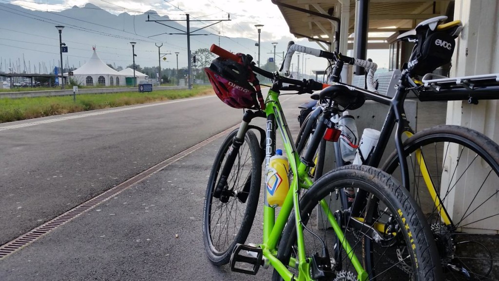
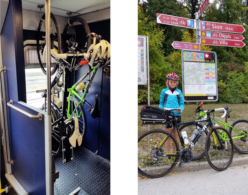
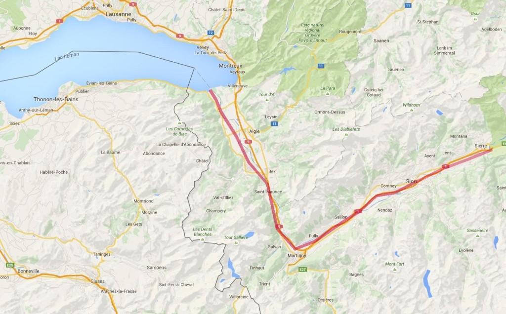
This day trip works for anyone based in the Portes du Soleil and Chamonix. Reaching the Rhone valley from these places is quick and easy. I live in the Portes du Soleil (St Jean d’Aulps) so my nearest connection with this trip is 1 hr away in Bouveret. We drove down there on a Saturday morning to catch the train up the Rhone. As you can imagine the Swiss trains run like clockwork, not only that they are pretty good at “Clock-face scheduling” too, so the train from Bouveret leaves at 10:01, 11:01 12:01 and so on throughout the day, Sunday’s included. Knowing this makes working out where the train will be a fairly easy guess. We bought our tickets from the platform machine (40CHF total for us for the 90km to Sierre), loading the bikes onto the train is easy, just make sure you go through the door with a bike marked on it! There are obvious places to rack or hang the bikes for the journey. 20 minutes later we arrived in St Maurice for the change onto the faster train to Sierre. The connecting train times match perfectly, so you have about 3 minutes to get off one train and get onto the next.


2015-10-03 11.15.40

We arrived in Sierre 1hr after setting off from Bouveret. Although I had downloaded the Swiss Mobile mapping app for my phone I didn’t fancy trying to navigate out of this fairly large town by phone so I popped into the Tourist Office. They pointed me in the direction of some very obvious signs. Once we’d found them navigation was easy!

rhone_cycle_route_6

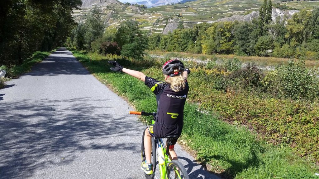
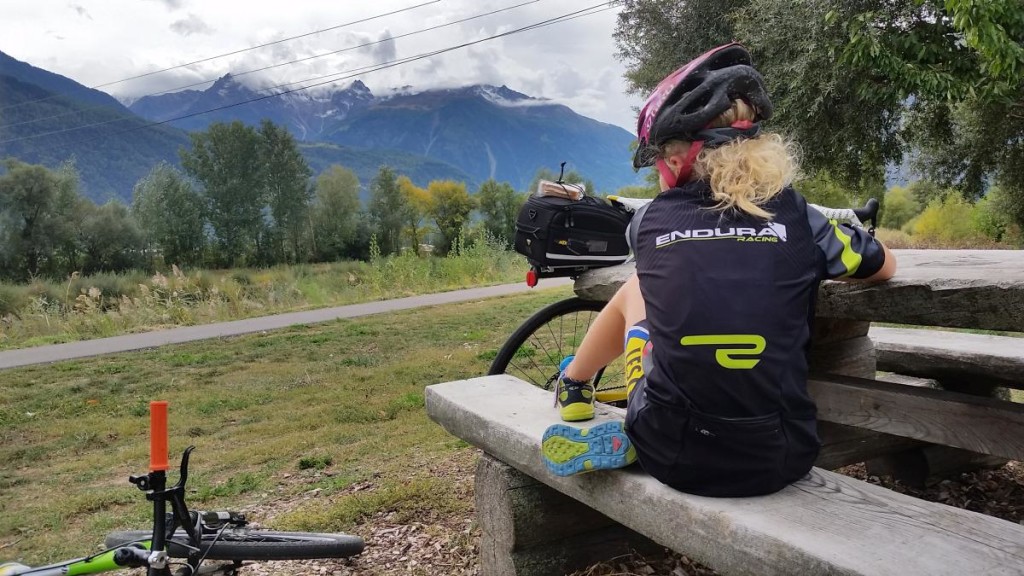
We travelled through lots of apple orchards and vineyards, with views of the terraces and small villages surrounding the Rhone Valley. A close look reveals ski areas like Crans-Montana, Nendaz and Verbier and twice that number of smaller resorts only the locals know the names of. We traversed the towns of Sion, Martigny and Monthey. We stopped at a café in Sion for some lunch, I guess there would have been something in Martigny too but we skirted the town centre. Otherwise there are a few picnic tables and some water stops along the route.

rhone_cycle_route_8

rhone_cycle_route_7

The really flat bit of this route starts from Brig, from there to Bouveret and Lac Leman is about 120km, throughout that distance the route descends imperceptibly at about 150m per 100km. We rolled along at an average speed of 15km/h. After 70km my daughter was flagging somewhat so we pulled up at the train station in Monthey and caught the train back to Bouveret, this saved us the last 20km and prevented the day turning into an epic. I suspect this route is fine for cyclists 90% of the year, the bottom of the valley is generally free from snow. The main hazard for cyclists can be the wind. It is very hard to predict here, if you have an idea which way it will be blowing you can use the train to take advantage of it! I have had a 70km/h wind on my back in the past. That is enough to double your speed for no added effort. Trying to cycle into a headwind like that may well turn out to be impossible though!

map

Image2

Property Prices across the Haute Savoie

I am often asked about current and historical property pricing data in the Haute Savoie. It is a fair question. In the UK very accurate and open data is available. The answer for France is not quite so straightforward. The Notaires collect all the data, it is publicly available on a broad scale. More accurate information is available on a pay basis, it’s not easy to get though. the free stuff has to be read with caution!

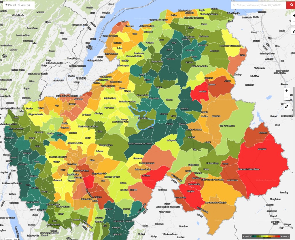
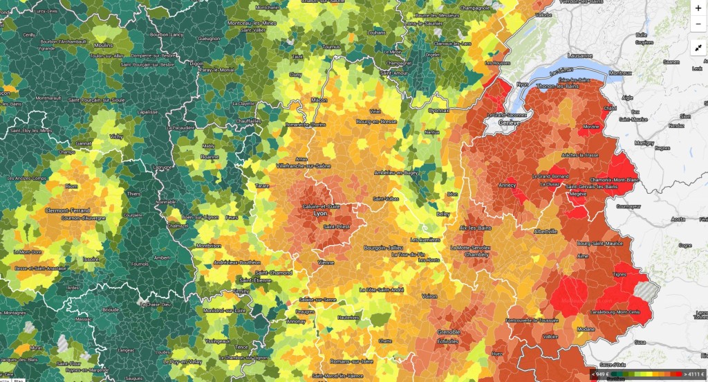
Below is a coloured map of the Haute Savoie, the redder the colour the more expensive the commune. It makes sense, Chamonix, Megeve, La Clusaz, Annecy  and Les Gets come out as the most expensive. Followed by Morzine, Combloux and the rest of the Chamonix valley. Manigod, Le Grand Bornand and  Chatel follow along after that. Samoens should be in that last group too but a quirk of stats has knocked it down a peg.

prix immo

You can click on the image and make it huge or go to the website I took it from.

http://www.meilleursagents.com/prix-immobilier/bonneville-74130/

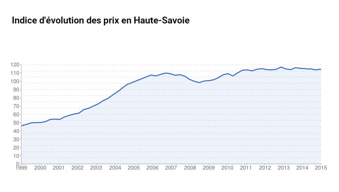
Take the actual value/m2 with a pinch of salt, this always reads too low in our experience. The price trend graph looks about right though. But read the title, it is for the whole of the Haute Savoie and not for each commune as it seems to suggest on the website! So it shows a massive price increase between 1999 and 2007, a small drop for the following 2 years and then stability. We think this will start to climb again at the end of 2015 and into 2016 driven by the weakened Euro compared to Sterling.

property price evolution

If you zoom out a bit on the commune map you start to see what sort of bubble there is in the ski areas. We already know that you only have to drive 15 minutes from the resort to see the prices half, well looking at this and you’ll see you have to drive an hour from the resort and the prices drop to 25%.

prix immo 2

Chalet d’alpage, a little history.

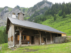
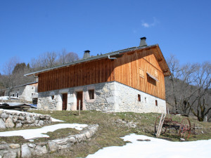
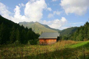
The Chalet d’alpage are the mountain chalets that you come across far from the tarmac road, they almost (but not always) have 4×4 access and in winter the access is normally on foot, snowshoe or ski. These are the ancient summer residence of the farming communities that used to be the life of the Alpine valleys. In winter the cattle would be stabled in the valleys and in summer the cattle and the farmers would move up to the high pastures. The cattle would be milked in situ and cheese made on the spot too. This still goes on but for the whole process to be done in the old way is rare. The only place I can think of in the Morzine valley is the Ferme Auberge de Freterolles. I’ve just Googled them and see they have a page on TripAdvisor! Another is LaPisa just over the border in Switzerland. They have a website too. If you pass in the summer you will see them heating their milk over a wood fire.

Farming in the Alpine valleys fell apart after the First World War, the Alpage were abandoned by most families as they lost their men to the fight. The requirements of industry pulled the young out of the valleys to the cities too. During the period between the Wars the tourist industry in the Alps started up. The Second World War was less devastating to the population but then skiing arrived. This industry was much more lucrative and was the final nail in the coffin for Transhumance .

Nowadays these chalets are generally retained by the original families and used as weekend retreats. They require a lot of upkeep though and they need owners that treat them as a labour of love. I have often heard it said that corrugated iron is the saviour of the Chalet d’alpage. Without that cheap lightweight covering most of the properties will have rotted away. Now at least roofs are easy to repair and a property can be “kept on ice” until someone in the family comes along to look after it.

Rarely do these properties come for sale. When they do they are very sought after. Often they are more expensive than you might imagine! We don’t have a category on our website for “Chalet d’alpage” because we never have that many to sell. I’ve had a look through and have found 4 at one time. This might be a record!

Chalet Paradis
For Sale: 273 000 €
Le Petit Bornand Les Glières
https://www.alpine-property.com/le-petit-bornand-les-glieres/chalet-paradis/2608

fermelorchat1_2

Chalet Sous Les Crètes (next to the pistes!)
292 000 € Habère Poche
https://www.alpine-property.com/habere-poche/chalet-sous-les-cretes/2494

souslescretes_4

Chalet Berger (comes with vehicle for all year round access)
495 000 € Mégevette
https://www.alpine-property.com/megevette/chalet-berger/2618

chaletberger_5

Chalet d’Alpage Bonnavaz
225 000 € Les Gets
https://www.alpine-property.com/les-gets/chalet-dalpage-bonnavaz/2343

alpagebonnavaz_2

Swimming across Lac Leman

Swimming across lac Léman

AKA Lake Geneva to the English

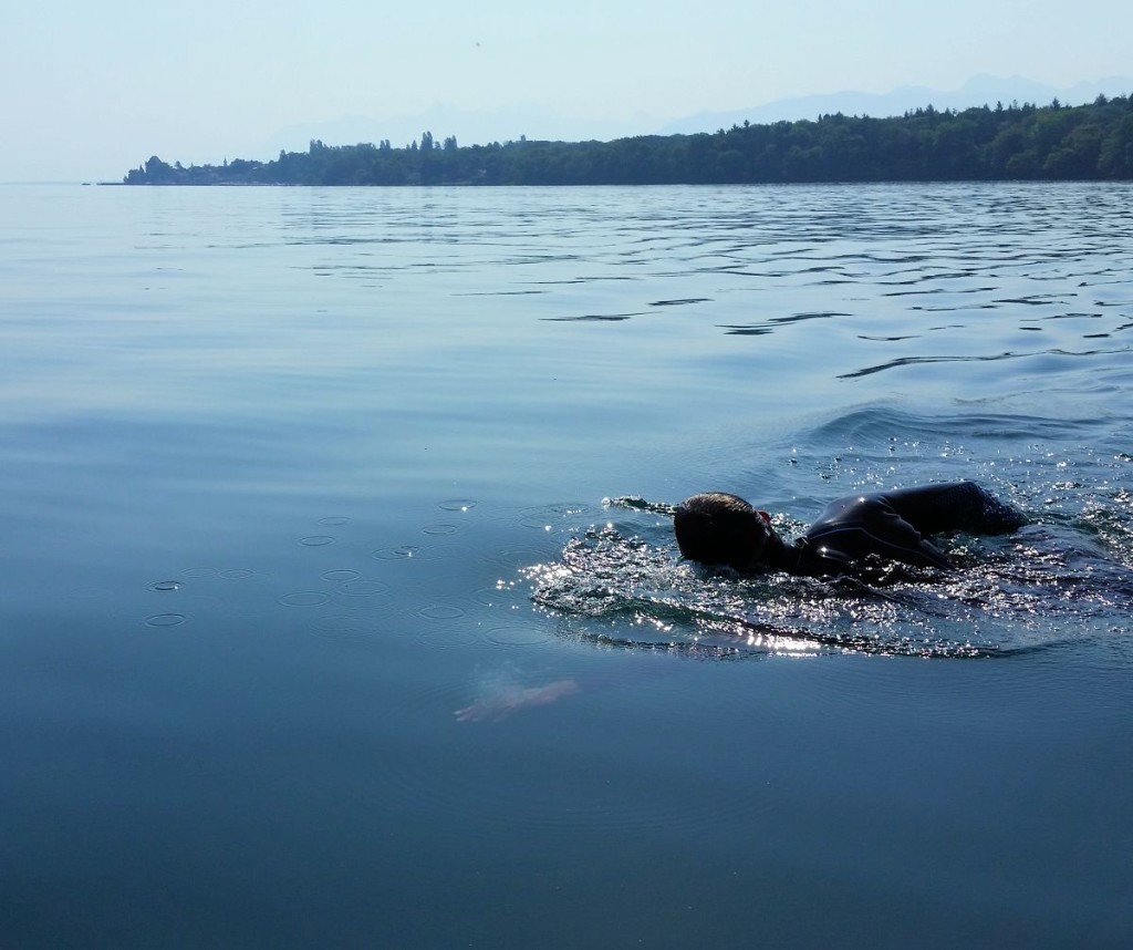
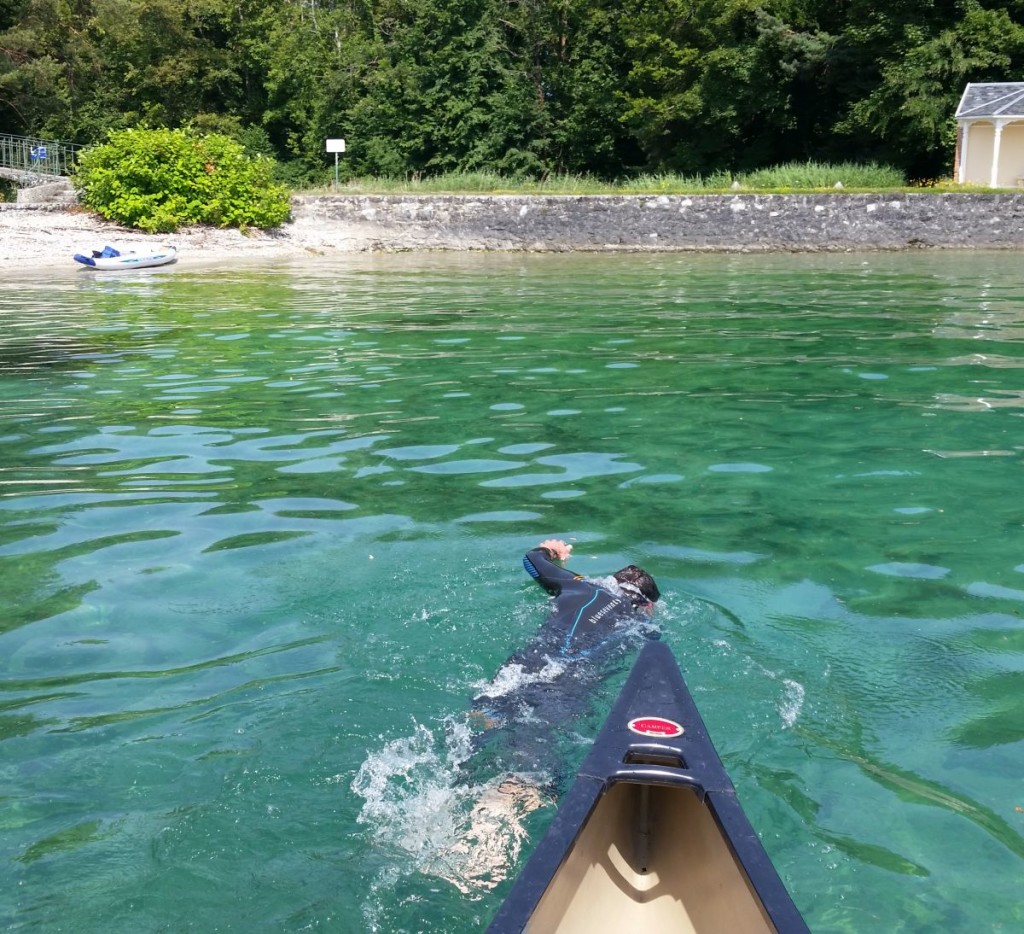
During the heatwave last week (first week of July 2015) we decided to take the opportunity of a very warm Lac Léman  to swim from France to Switzerland. We are not superhuman so we left the “classic” traverse from Evian to Lausanne alone (13km) and headed for the narrowest section instead. From Nernier to near Prangins (3.5km according to the map)

Image1

Nernier is a small quiet and picturesque little village. The is minimal parking available so get there early in the holidays. We arrived at 9.30am and found somewhere fine. You can drive down to the water’s edge if you need to drop off a boat but it’s not easy and best avoided. There is a public toilet at the Port if you need one.

2015-07-02 10.04.55

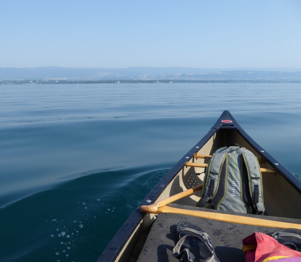
We were a little worried about the various hazards the lake can present. We’d checked the weather forecast and there were no strong winds likely, go before 10.30am and the lake is most likely to be mirror smooth too. After this time the thermic breezes will start up adding some ripples. There is a regular ferry service which doesn’t like to give way to anything but it’s only an issue close to the port of Nernier, if you don’t set off or arrive as it is docking or leaving it should not be an issue.

P1000290

The temperature of the lake changes very quickly. Up to 2 °C from the morning until the evening on a hot day. It’s easy to gauge with this website though.

http://meteolakes.ch/#!/hydro/geneva

The figure you need is the “Température eau 1m”. On our day it was 21 °C which was fine without a wetsuit. The only hazards we encountered where the occasional small wakes from passing boats.

P1000304 big

The headland we landed on is private land, there was noone around though and it’s not overlooked. There is a sign which politely asks that you don’t venture beyond the beach.

2015-07-02 11.21.19

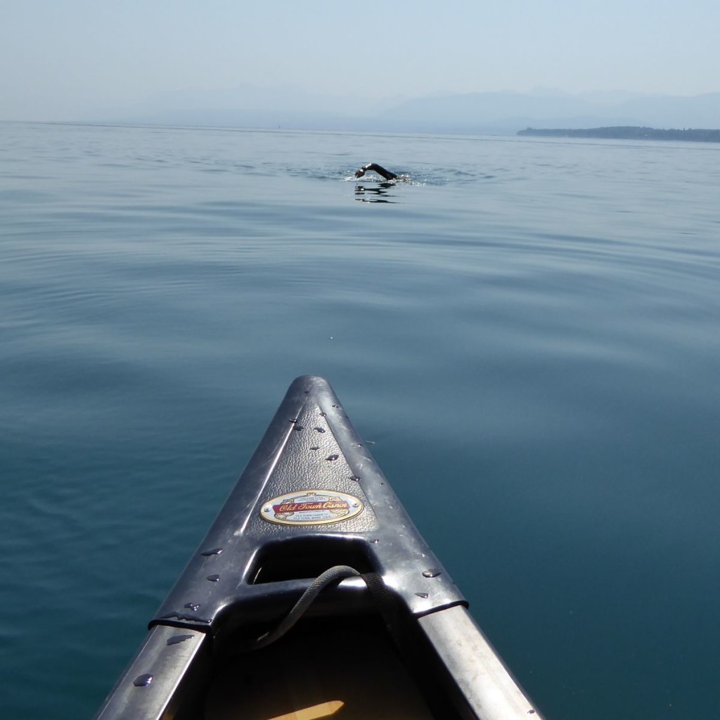
We used a GPS to track our actual route, this is my return swim (the two of us took turns swimming and paddling the canoe), we had been heading towards the wrong landmark so had to change direction half way! According to the GPS it was a 4km swim which took 1hr 15min.

Image3

Campsites in the Portes du Soleil

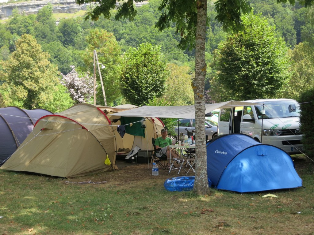
The campsites around the Portes du Soleil are “fine”.  However they cannot be compared to the really big campsites available around France. No swimming pools in the campsites around here! I’ve made a list as a resource.

Camping in the Haute Savoie

The best campsite in the Portes du Soleil is probably in Chatel.

Camping L’Oustalet 4*
http://www.oustalet.com/

For the Morzine area there are two.  I know some people prefer the camping in Essert Romand, though Le Pré in Montriond offers better access to the river trail for bikes and dog walking.

Essert Romand
Camping Les Marmottes
http://www.campinglesmarmottes.com/

Montriond
Camping Le Pré 2*
http://www.savoie-mont-blanc.com/en/offre/fiche/camping-le-pre/74356

The best views are from this one in Les Gets, though it is quite a hike up the hill. No website that I can find.

Camping d’été La Grange Au Frêne
http://www.lesgets.com/les-gets/hebergement/campings.html

Camping in St Jean d’Aulps is just by the main road . It is walking distance from the shops though and it’s on the river trail and very near the stables for horse riding.

Camping Le Solerey
http://www.valleedaulps.com/camping-le-solerey-1.html

For short stays, there is the municipal camping at La Baume. It’s bound to be the cheapest option too.
Camping Municipal De La Baume, call 04 50 72 10 06, open July and August

camping 2

You don’t have to go far for some bigger and better options though.

Samoens
Camping Le Giffre 3*
http://www.camping-samoens.com/

Or there are a number down by Lac Léman (Lake Geneva). These two are by the beach at Excenevex.

Camping La Pinede 3*
http://www.camping-lac-leman.info/

Camping La Pourvoirie des Ellande 2*
http://www.camping-lac-leman.com/

Rain across the SE of France, the Haute Savoie gets flooded!

After 36hrs of continuous rain the Haute Savoie has woken up to floods, damage and a fair amount of clearing up to do. According to the Dauphine Libere, the rainfall figures are:

– Est de l’AIN : 50 à 80 mm localement 130 mm à Chézery
– SAVOIE : 50 à 90 mm localement 140 mm (Valmorel, Aillon-le-jeune)
– HAUTE-SAVOIE : 60 à 100 mm localement 175 mm à Thônes, 190 mm aux Gets.
– ISÈRE : 50 à 80 mm sur le relief, localement 120 mm à St-Pierre-les-Egaux, 160 mm au Verney.

You’ll see that Les Gets takes the rather soggy biscuit.

I took this picture yesterday, the Passerelle in St Jean d’Aulps, shortly after the Commune turned up with a digger and removed it!

passerelle2

a before and after video of the bridge.

.and then this was taken the next day, if you watch you’ll see a big tree being uprooted.

I’ve been out this morning and taken quite a few pictures around Morzine and St Jean d’Aulps.

passerelle

This is the same spot, the bridge is gone, the river is twice as wide and the school is starting to lose its playground.

river trail 2

Further up the valley, this is the “river trail” across from Carrefour, or it was, it’s totally gone and there is no prospect of replacing it. If things carry on like this we’ll lose the road next.

river trail

More “river trail” pictures, this one is up by the Plagnettes roundabout.  No sign of the trail here. This at least is repairable.

Plagnettes

Plagnettes again, near Morzine, the owners of the house probably had a sleepless night.

verd

Lac de Montriond and the Verdoyant.

montriond lac

The Bout du Lac end of the lac.

Les Mouilles

Near my house!

Some background to the episode here.

http://meteonews.fr/fr/News/N4270/Pluies-abondantes-en-France-ces-derniers-jours

The previous record for rainfall in Chamonix was 59mm (May 2010), this time they got 81mm. Les Gets got 190mm!

Extra Slippy Snow Forecast for this weekend?

Watch out, if it snows this weekend, the roads may well turn out to be slippier than normal. I’ve experienced this a few times and wondered what was causing the effect. Is it because snow in spring is wetter? Is it the wrong sort of snow? In my opinion it’s neither. It’s probably just because your winter tyres have worn out.

I used to drive 15,000 km over the winter season. I always started off in November with fresh winter tyres and they would see me through the difficult months of December and January just fine. The roads would start to dry up and I’d drive through February and into March without a second thought. The occasional snow storm tends to blow through in March and April, the effects don’t last long down in the valleys but you will still need to be careful when out driving. 15,000km is probably the furthest you’ll manage on a set of snow tires (it could be less than 10,000km). The trouble is they still look fine at this point and are perfectly legal. They will probably have lost all their winter qualities though.

Obviously none of this will mean anything to you unless you actually look at how much tread there is left on your tyres. Something I can’t help doing to any car I see, it’s a leftover from my old job.

Here are some Winter Tyre facts and some opinion too.

  • When living in the Alps winter tyres on a 2WD are generally fine. In fact most of the time they handle better than 4WD cars even on snow.
  • If you have to deal with any hills then you’ll probably need a 4WD. I mean “real hills”, the main roads in the Alps don’t count. But beware. 4WD helps with traction up a hill but it won’t slow you down – in fact 4WD cars can be harder to handle downhill due to their weight. They won’t help you around corners either!
  • Snow tyres have 8mm of depth when new, 4/5mm when used, 1.6mm is the legal requirement. There will be two TWI’s (tread wear indicators), the winter one is not always that obvious.
  • M+S tyres are not a patch on Snowflakes. This might sound like gobbledegook. A winter tyre has a snowflake symbol, an “all year” tyre is often marked as M+S (mud and snow), these are not the same and not a patch on winter tyres. They lack the softer rubber and the sipes (see image below)! You see them frequently on the big 4WD’s from out of town. There is a link to a discussion on this subject here. and one from a manufacturer here.
  • Winter tyres are not good in summer so change them! They are worse than the worst summer tires you can buy. It’s tempting to run them whilst they are legal but it shows a total contempt towards your own safety.

Some people complain about the cost of winter tyres, the hassle of storing them and the fact the whole lot need changing 2x a year. The real running cost of tyres is about 1.5 cents per km winter tyres come out at about 2 cents per km. And remember, whilst you are using the winter tires the summer ones are being saved.

Some general links on the subject here.

http://tires.canadiantire.ca/en/info-centre/winterTiresBuyingGuide/

http://www.caranddriver.com/features/winter-traction-test-what-price-traction-the-bottom-line-page-4

winter-tyre-snowflake

The Snowflake and M+S marking are often seen together. If there is no snowflake, then you don’t have a winter tyre.

The treadwear indicators often look like this.

twi 2

But they can look like this. These are easier to spot, when the tyre is worn out then a smooth line appears across the surface.

twi

Here is a picture showing off tyre sipes. It links to lots more.

sipes

Why do I think I know what I’m talking about? I took my driving skills gained in the Police in the UK and also 2 seasons of driving transfer vehicles in the Alps to train new drivers for the Tour Operators. I did this for 10 years. I used and fully tested a huge range of vehicles in winter in that time, including all sorts of minibuses, 4WD’s, Land Rovers and company cars.

Snow Socks or Snow Chains?

During the last snowfall I stopped to help someone who was stuck on the side of the road. They were struggling with their Snow Socks. I’ve always wondered about these things. Do they do the same job as a Snow Chain? This guy had put his snow socks on his front wheels, unfortunately he was driving a Mercedes, which was rear wheel drive. Now he was stuck and seemed to have a big issue on his hands. To move the Snow Socks from the front wheels to the back wheels he was having to jack the car up. In the snow, by the side of the road. Not a good day out. I’ve done a little research and have put the fruits of my labour down here.

snow sock

  1. Driving on snow in Snow Socks is better than using nothing at all.
  2. Winter tyres are better. So if you have newish winter tyres, don’t put socks over the top.
  3. Snow Chains beat them both for traction in very snowy conditions but some people find them hard to put on. My advice is to do some practice! My 12 yr old can get 2 chains on in 2 minutes. He’s available for hire…
  4. If you cannot move your car, you can still put chains on and get going again. You’ll probably need a shovel to dig around the wheels but at least you can help yourself. However you cannot put Snow Socks on the wheels when you are stuck! Not without jacking up your car.
  5. Snow Socks do count as “winter equipment” on the French roads and have done since 2010.

So, learn to put chains on. Put them on before you need them too. If this is beyond you then get some Snow Socks, they are much better than nothing. YOU WILL HAVE TO PUT THEM ON BEFORE YOU NEED THEM THOUGH and obviously on the drive wheels of the car! I’ve made a video here

There is a nice explanation of how to use Snow Socks here