Rhone Route by bike (Swiss bike routes, Route 1)
This is part of my long series of “things to do in the mountains that don’t necessarily involve mountains”. Sometimes the kids don’t react well to my “lets go for a walk up a mountain” routine on the weekends and I’m left wondering what else to challenge them with. My youngest is almost 10 and she is very keen on her bike. It can be a hard to find different routes to try out of season from our base in the Portes du Soleil. Her previous distance record was 40km around lake Annecy, when I suggested we try and beat that she was keen.
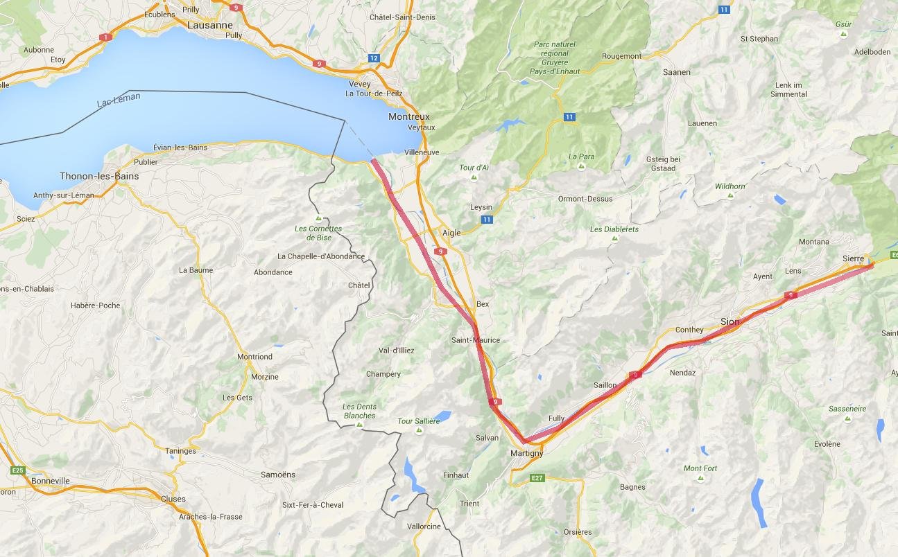
I had in mind that the Rhone valley (the Swiss bit) might provide an almost flat route that would suit the challenge. I’d also like to stay on cycle tracks. It helps us both stay sane. Whatever anyone says about how safe cycling is, mixing 9 year old’s and busy roads is not recommended.
I’m going to stop emphasising that we did this in Switzerland now. Just to say, that one day this cycle path will extend through France to the Mediterranean coast. At the moment it is not finished. More information on the French route is available here http://en.viarhona.com/the-route
Full details about the 350km that is finished and open in Switzerland is available here:
http://veloland.myswitzerland.com/en/routes/route-01.html
This is a small part of the amazing Swiss website “SwitzerlandMobility, the network for non-motorized traffic“, probably the best bike touring website in the world.
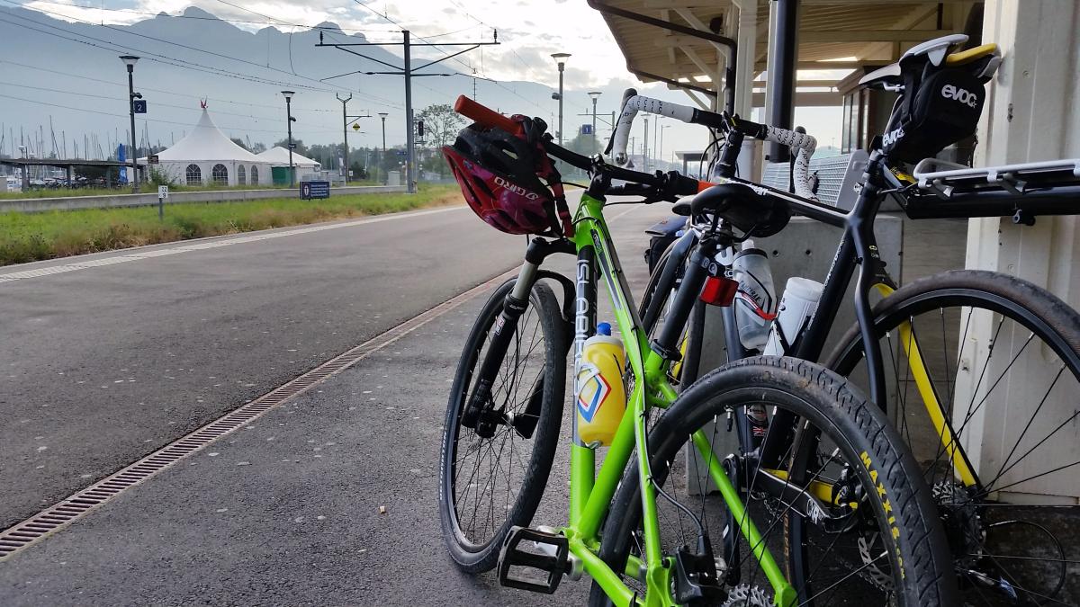
This day trip works for anyone based in the Portes du Soleil and Chamonix. Reaching the Rhone valley from these places is quick and easy. I live in the Portes du Soleil (St Jean d’Aulps) so my nearest connection with this trip is 1 hr away in Bouveret. We drove down there on a Saturday morning to catch the train up the Rhone. As you can imagine the Swiss trains run like clockwork, not only that they are pretty good at “Clock-face scheduling” too, so the train from Bouveret leaves at 10:01, 11:01 12:01 and so on throughout the day, Sunday’s included. Knowing this makes working out where the train will be a fairly easy guess. We bought our tickets from the platform machine (40CHF total for us for the 90km to Sierre), loading the bikes onto the train is easy, just make sure you go through the door with a bike marked on it! There are obvious places to rack or hang the bikes for the journey. 20 minutes later we arrived in St Maurice for the change onto the faster train to Sierre. The connecting train times match perfectly, so you have about 3 minutes to get off one train and get onto the next.
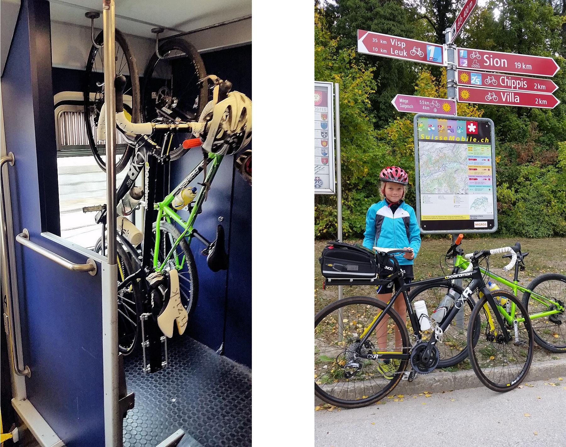
We arrived in Sierre 1hr after setting off from Bouveret. Although I had downloaded the Swiss Mobile mapping app for my phone I didn’t fancy trying to navigate out of this fairly large town by phone so I popped into the Tourist Office. They pointed me in the direction of some very obvious signs. Once we’d found them navigation was easy!

We travelled through lots of apple orchards and vineyards, with views of the terraces and small villages surrounding the Rhone Valley. A close look reveals ski areas like Crans-Montana, Nendaz and Verbier and twice that number of smaller resorts only the locals know the names of. We traversed the towns of Sion, Martigny and Monthey. We stopped at a café in Sion for some lunch, I guess there would have been something in Martigny too but we skirted the town centre. Otherwise there are a few picnic tables and some water stops along the route.


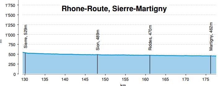
The really flat bit of this route starts from Brig, from there to Bouveret and Lac Leman is about 120km, throughout that distance the route descends imperceptibly at about 150m per 100km. We rolled along at an average speed of 15km/h. After 70km my daughter was flagging somewhat so we pulled up at the train station in Monthey and caught the train back to Bouveret, this saved us the last 20km and prevented the day turning into an epic. I suspect this route is fine for cyclists 90% of the year, the bottom of the valley is generally free from snow. The main hazard for cyclists can be the wind. It is very hard to predict here, if you have an idea which way it will be blowing you can use the train to take advantage of it! I have had a 70km/h wind on my back in the past. That is enough to double your speed for no added effort. Trying to cycle into a headwind like that may well turn out to be impossible though!