This post is also available in: Français (French)
Is the Col de Joux plan open or closed? The answer is further down. First I will set the scene.
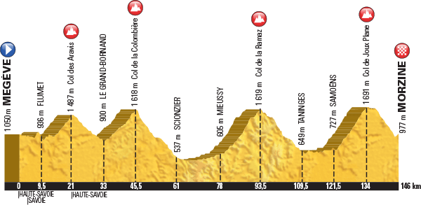
The Tour de France is coming to the Haute Savoie in 2016. The Queen Stage is Stage 20, the penultimate stage but final day of racing. It’s from Megeve to Morzine and scheduled for Saturday July 23rd . 146km long with about 3,500m of ascent. To add to the hype this stage has also been chosen as the Etape de Tour 2016 , this will be held on July 10th. 15,000 riders are signed up, it’s so popular the entries closed back in 2015! There are all sorts of previews of the route available on the web, this is one of the best.
The climbs are iconic, the Col des Aravis, Col de la Colombiere, Col de la Ramaz and Col de Joux Plane, because of this many cyclists are trying to ride the route prior to the event. The issue is that they have been covered in snow all winter and 3 important sections have major road works on them!
So are they open or closed? I’ll write this from my own knowledge, updated on May 19th/2016 ,I’ll add some pictures and other resources that might help at the end.
In order that they’ll be ridden.
Col des Aravis, no issues here. This stays open all year
Col de la Colombiere, closed to traffic but being ridden by many. No major issues.
Col de la Ramaz, officially closed but the summit is passable over about 300m of gravel. It needs tarmacking. This won’t put most cyclists off. Passable by car too. Though officially closed.
Descent from Praz de Lys to Taninges. Just before the Pont des Gets at 1100m altitude the road is closed to traffic thanks to a long term issue with a landslide. There is an official diversion via the Col de l’Encrenaz which works well for cyclists based in Morzine or Les Gets but it is a big detour for someone trying to ride the official route. UPDATE MAY 21st … In fact the issue (pictured below) is the fear of a spontaneous release on the landslip. There is a wall protecting the road and it is easy to pass. When this section is open the council erect traffic lights and place two full time “spotters” to keep an eye on things. Maintaining this presence out of season obviously costs too much – hence it is closed.
Col de Joux Plane, closed to traffic thanks to ongoing repairs to a landslip at 1640m altitude, just down from the Col du Ranfolly on the Morzine side. It is passable on the weekend by a bike but not recommended, crossing the hole with the bike on your shoulder is slippery and muddy too. I suspect a cyclist will be turned away when the building site is operational.
UPDATE 06/07/2016
The hole on the Joux Plane has been repaired!
Out of interest, the Joux Verte road from Linderets to Avoriaz is closed to traffic but passable by bike.
Further resources are available on these links.
These are probably the best, though currently they differ from my first hand knowledge.
http://www.cols-cyclisme.com/ouverture-cols.htm
http://www.sport-passion.fr/parcours/etat-cols.php
This is the official one.
and for the Haute Alpes
https://www.inforoute05.fr/wir3/cols.html


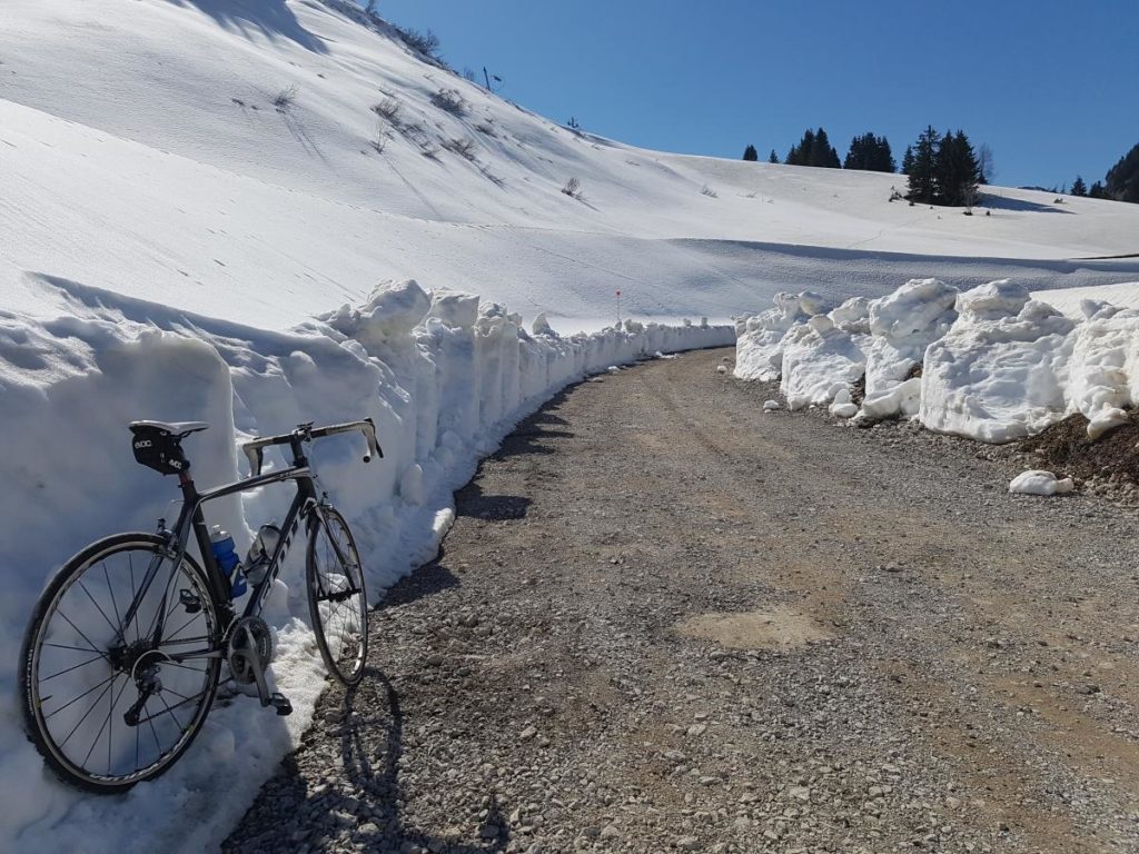
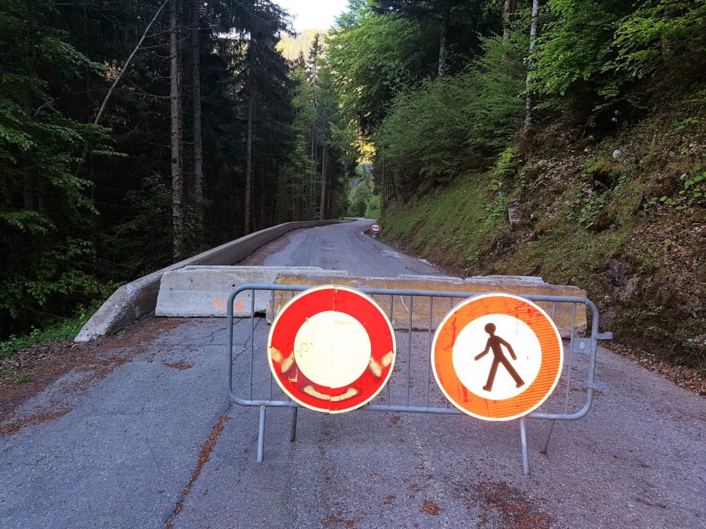
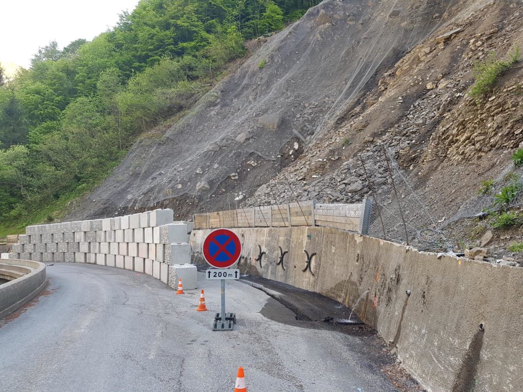
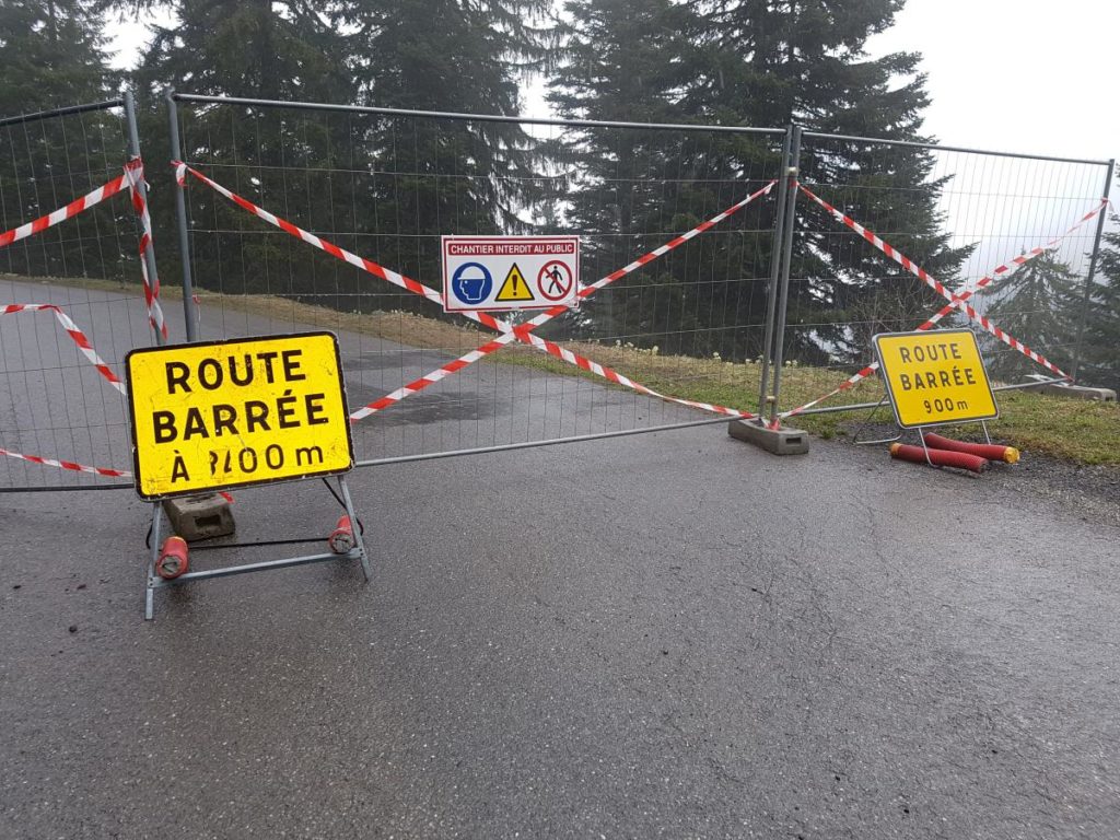
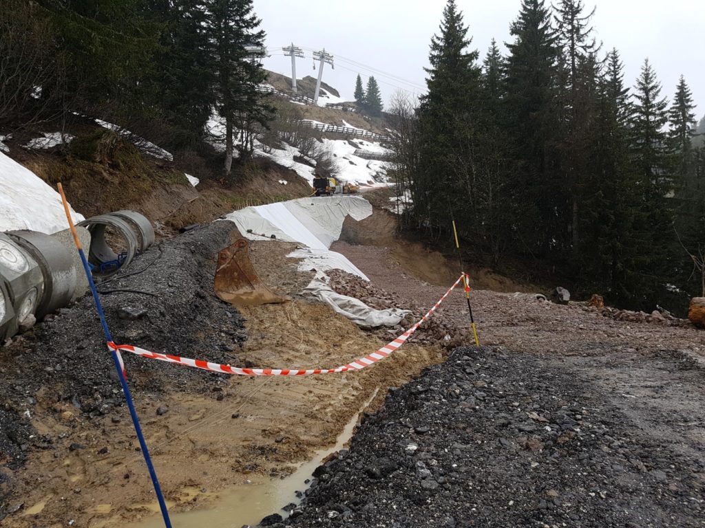
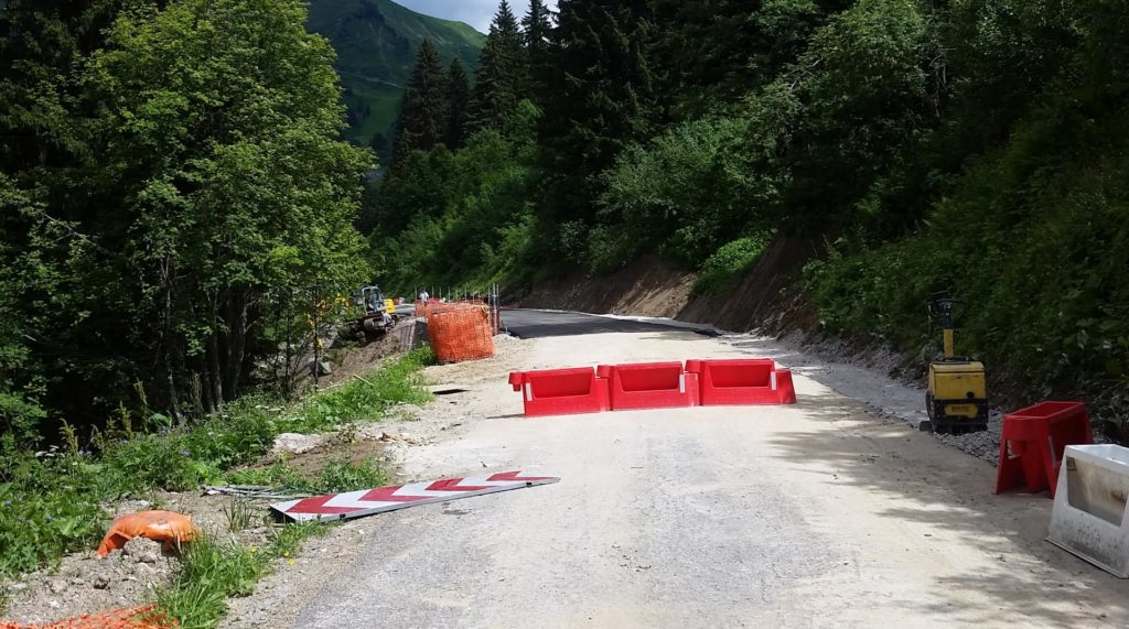
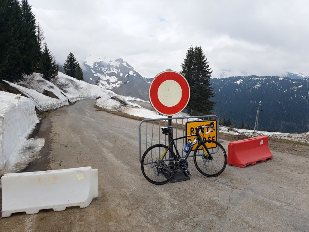
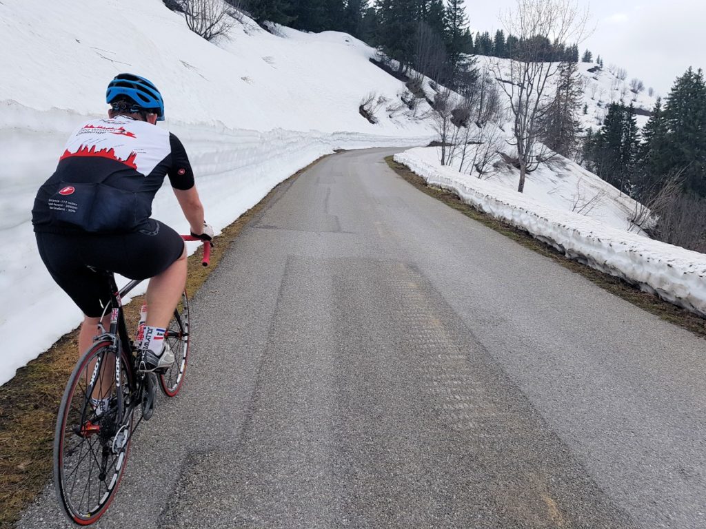


I’ve updated this as of today, although the descent off the Ramaz towards Les Gets is officially closed, you can see from the pictures it is easy to pass.
Done Joux Plane and Ramaz in last couple of days both, both sides. Situation the same. You can get throughout with a bit of rough riding and portage. Hard to find any good local intelligence on prospects for getting repairs done in time for etape/TdF but there’s nothing much going on at present. Particularly hard to see how they can fix the big gap in the road on the back of the Joux Plane in time.
Adam, thanks. I’m confident they’ll patch up the Joux Plane but it looks like they don’t have any plans in the short-term for the landslip on the Les Gets side of Praz des Lys (the Ramaz descent), the question will be if the organisers of the Etape are happy to allow 15,000 riders pass the narrow bit, in the middle of a steep downhill! We’ll see…
Ramaz was the same as the photo when I went down it on 6th June.
Joux Plane was passable too but was also as per your photo. Work has started pinning the road. The workmen didn’t give me a second look but could probably smell my fear as i carried my bike along a 20cm wide plank at the top edge of the 5+meter drop.
Richard, thanks. From reports over this last weekend…I think it remains the same!
ROUTE MODIFICATION
July 4th 2016
For several weeks, part of the route of L’Etape du Tour was at risk due to falling rocks level with the descent of the Col de la Ramaz.
We hoped that we could offer you an unmodified route, identical to the one announced when the registrations were launched.
However, the competent authorities and the organisers believe it is preferable to not take the Col de la Ramaz. Although the area has been secured for motorized traffic with automatic traffic lights which are activated in the event that rocks fall, the passage of 15,000 cyclists for several hours represents an additional risk.
Nevertheless the modified route will represent a major sporting challenge: 122km and 2,873m of elevation gains.
The start times haven’t been modified. You can find the sporting information that has been updated in the different sections of the website.
For the 20th stage of the Tour de France, which will be held on 23rd July, 10 days after l’Etape du Tour, a decision will be made the day before it takes place, according to how the situation has evolved.
David, thanks for your explanation. Good luck to the organisation!
Update on the Joux Plane…looks like the hole is filled.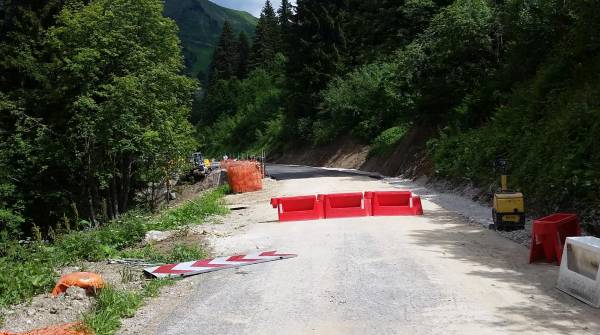
Hi re your comment about Joux Verte road from Linderets to Avoriaz being passable by bike. In summer can I get from Morzine to Pas de Morgins on a road bike without having to take the main road through Abondance or is it a dirt road unsuitable for road bikes?
It is unsuitable for road bikes, it would be OK on a cross or “gravel bike” but even then one section would be pretty steep. You can always walk or carry….but not in cleats!
Hi is it all dirt or only a short stretch. I can walk if I have to by taking my shoes off and putting jandels (kiwi for aussie thongs) on. Might be quicker than riding the long way around?
It’s all dirt though some of it is quite smooth dirt! the section marked in green is fairly flat and smooth dirst, the section marked in red is steeper and with more rubble. It’s 4km, 2km and then 2km. https://www.dropbox.com/s/ygajak0tegx5h0h/col%20de%20bassachaux.jpg?dl=0